

Laugenour and Meikle combines decades of professional surveying experience with advanced field technology to collect accurate, dependable project data. Our capabilities include GPS and robotic surveying, drone surveying and aerial mapping, hydrographic and bathymetric surveying, sonar water-depth mapping, and pipeline and utility locating. These technologies allow our team to document large, complex, underwater, and difficult-to-access project areas efficiently while maintaining careful quality-control standards.
From RTK aerial mapping and topographic surveys to underwater cross sections and underground pipeline mapping, our equipment supports civil engineering, land development, construction, water-resource, agricultural, infrastructure, and public works projects throughout Woodland, Davis, Sacramento, Yolo County, and Northern California. Most importantly, every technology is operated by experienced professionals who understand how to verify the information collected and convert it into clear, useful project deliverables.
Advanced Surveying Equipment & Mapping Technology
Decades of Surveying Experience combined with Modern Field Technology, producing highly accurate Surveys, Maps, and Project Data
If you have a project you'd like to speak with us about, please submit a request and we will be in touch.
Since 1953
Civil Engineering
Land Surveying
Planning
Northern & Central California
Combining Proven Methods With Modern Technology
Experts in Civil Engineering since 1953
While surveying technology continues to evolve, accuracy still depends on careful planning, established best practices, and attention to detail.
Laugenour and Meikle combines time-tested surveying methods with advanced equipment to collect detailed information efficiently without sacrificing quality. Depending on the project, our team may use multiple surveying technologies and compare the results to help confirm the accuracy of the final data.
This combination of experience, technology, and quality control allows us to provide reliable information that engineers, contractors, developers, public agencies, property owners, and other project professionals can confidently use.
Our Surveying and Mapping Technology

GPS Surveying Equipment
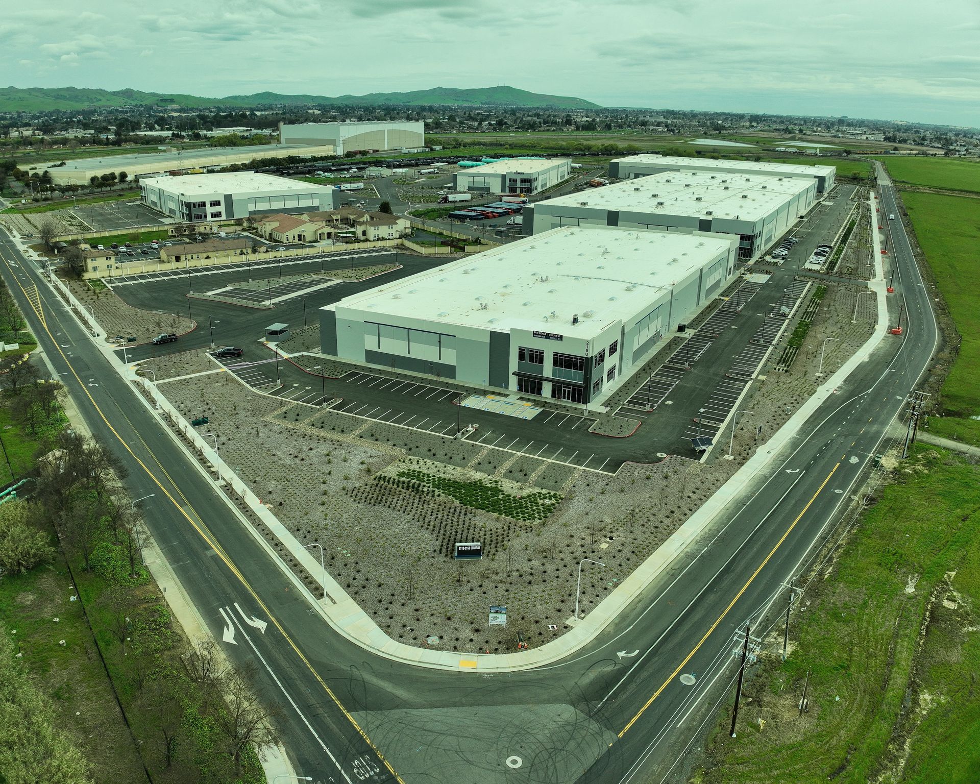
GPS-based surveying technology allows our crews to establish precise positions and collect field data efficiently across large or complex project sites. It can be used for boundary surveys, topographic surveys, construction staking, aerial mapping control, utility projects, and many other applications. GPS equipment helps our team improve field efficiency while maintaining the level of accuracy required for professional surveying work.
Conventional and Robotic Surveying Equipment
Conventional and robotic survey equipment remains essential when collecting detailed measurements, working around buildings or obstructions, and completing projects where direct line-of-sight measurements are required. Robotic technology allows survey crews to capture accurate field measurements efficiently while adapting to the unique conditions of each site. Laugenour and Meikle selects the most appropriate surveying method based on the property, terrain, project requirements, and desired final deliverables.
Civil 3D
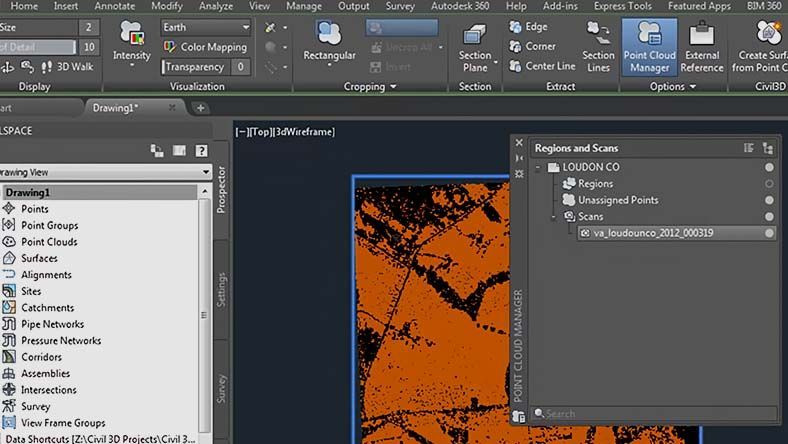
Autodesk Civil 3D helps our team turn collected field information into useful survey drawings, surface models, contours, maps, and other project documents. By integrating field data with civil engineering and drafting workflows, we can improve communication between surveyors, engineers, designers, contractors, and clients. This creates a more coordinated process from the initial survey through planning, design, and construction.
Hydrolite TM2 Focused-Beam Sonar
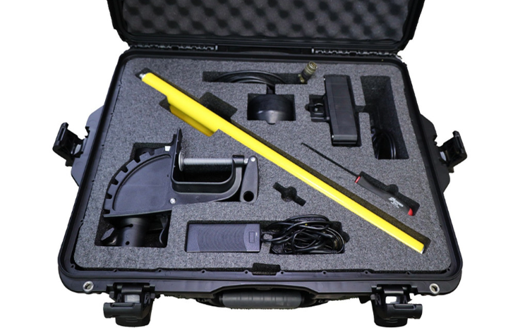
The HydroLite TM2 focused-beam sonar system supports hydrographic surveying by collecting water-depth measurements in ponds, canals, reservoirs, rivers, and other bodies of water. This equipment helps our team develop underwater cross sections and bottom-surface information for projects involving drainage, water resources, sediment conditions, infrastructure, environmental planning, and other specialized applications.
Seafloor HyDrone Remote-Controlled Survey Boat
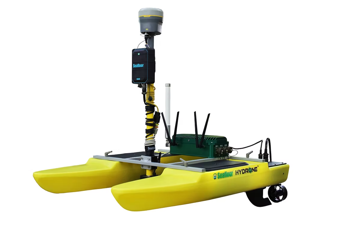
The Seafloor HyDrone allows our team to collect hydrographic information using a remote-controlled survey vessel. This makes it possible to gather data in areas that may be difficult, inefficient, or potentially unsafe to access using traditional methods. When combined with sonar and positioning technology, the HyDrone helps us efficiently collect detailed water-depth data while reducing the need to place personnel directly on the water.
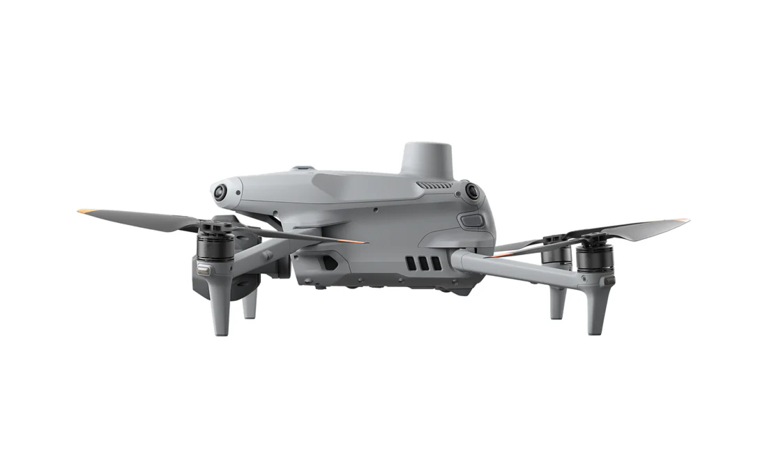
DJI Matrice 4E RTK Aerial Mapping Drone
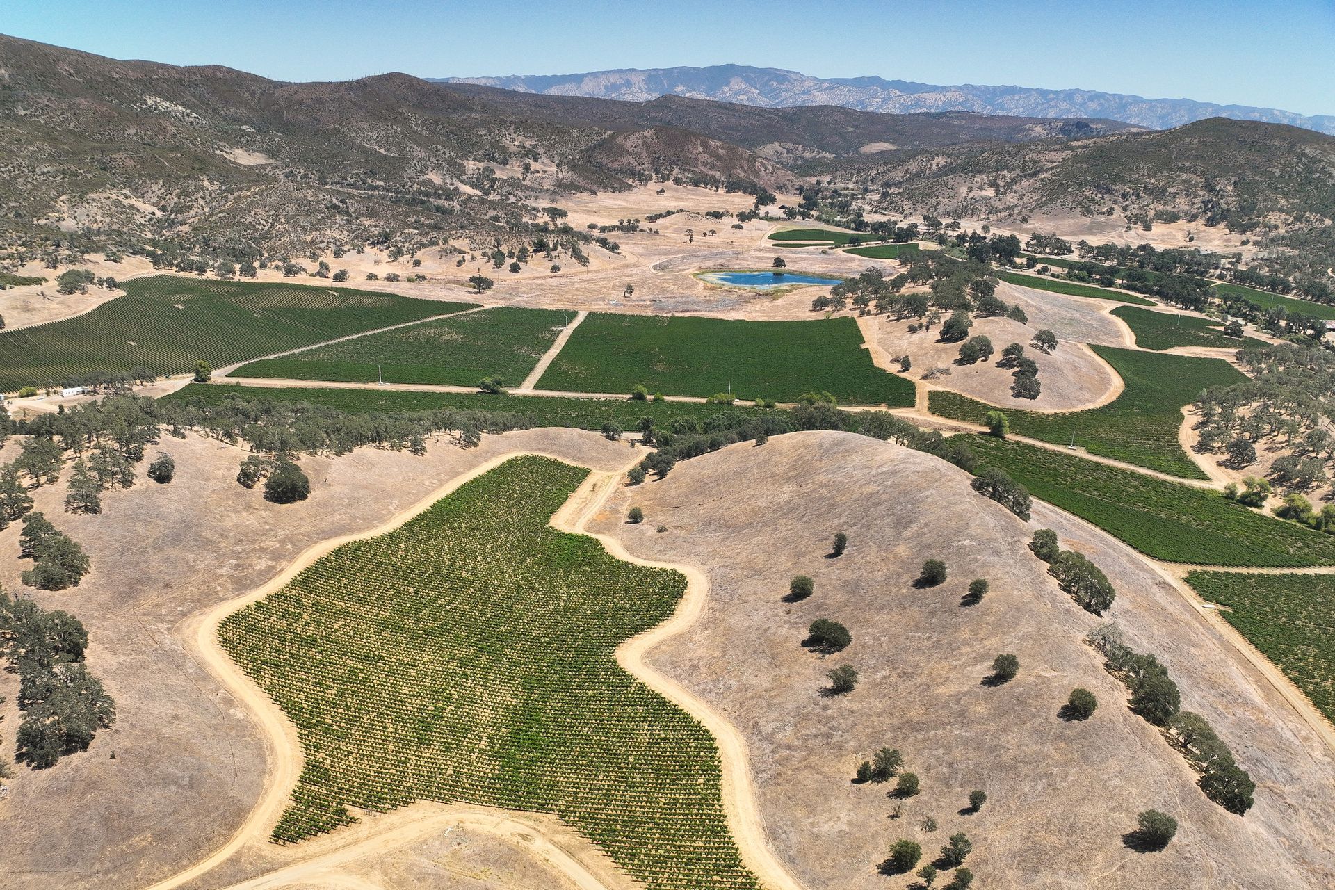
The DJI Matrice 4E RTK provides advanced aerial mapping capabilities for large, detailed, or complex sites. RTK positioning helps improve the accuracy of aerial data, while the drone’s imaging capabilities allow our team to document current site conditions from above. Depending on project requirements and site conditions, aerial mapping can support topographic surveys, construction progress documentation, site planning, earthwork analysis, and existing-condition mapping.
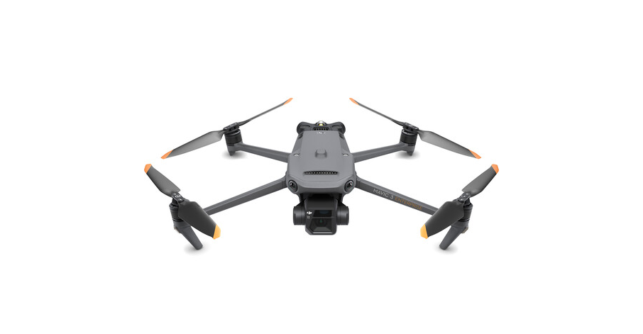
DJI Mavic 3E RTK Aerial Mapping Drone
The DJI Mavic 3E RTK offers a compact and flexible aerial mapping solution. Its portability makes it well suited for efficiently documenting a variety of properties and project areas. It can be used to capture high-resolution aerial imagery and mapping data that complements information gathered by ground-based survey crews.
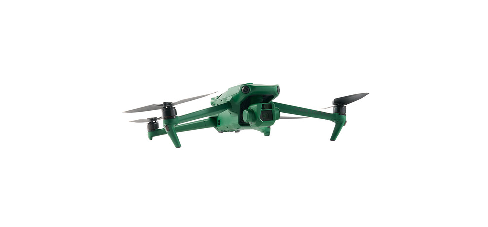
Anzu Robotics Raptor RTK Aerial Mapping Drone
The Anzu Robotics Raptor RTK provides another professional aerial data-collection option for mapping and site documentation. Having access to multiple aerial platforms allows Laugenour and Meikle to select equipment based on the site, project scope, flight requirements, and information that must be collected. This flexibility helps us approach each aerial mapping assignment with equipment suited to its specific conditions.
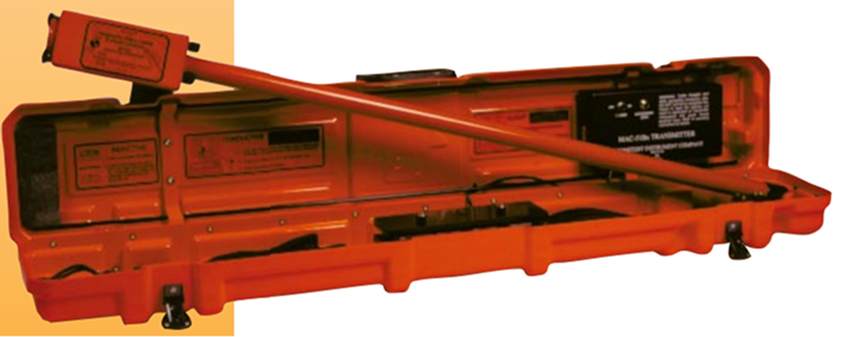
Schonstedt MAC-51Bx Pipeline Locator
The Schonstedt MAC-51Bx helps our crews locate and trace underground metallic pipelines and utilities before fieldwork or construction activities begin. Pipeline locating can improve site awareness, assist with utility mapping, and help reduce the risk of conflicts during design or construction. The information collected can also support pipeline staking and as-built documentation.
Why Our Technology Matters
Improved Accuracy
Advanced positioning, measuring, sonar, and aerial mapping equipment allows us to collect detailed project information and verify field conditions carefully.
Efficient Data Collection
GPS, robotic equipment, and aerial mapping technology can help our crews document large or challenging project areas more efficiently than traditional methods alone.
Access to Challenging Areas
Drones and remote-controlled hydrographic equipment allow us to collect information in locations that may be difficult or potentially unsafe to access on foot or by boat.
More Complete Project Information
By combining ground-based surveying, aerial imagery, sonar, and utility-locating technology, our team can develop a more complete understanding of existing site conditions.
Better Coordination
Our ability to process survey data through Civil 3D helps produce usable information for engineers, architects, contractors, developers, and public agencies.
More Than Advanced Equipment
What sets Laugenour and Meikle apart is not simply the equipment we own. It is how we apply that technology. Our team brings professional judgment, local knowledge, field experience, and careful quality-control procedures to every project. We understand that survey data often becomes the foundation for important property, design, permitting, and construction decisions. That is why we approach every assignment with a strong commitment to accuracy and detail. Technology helps us work more efficiently, but our people ensure the information is collected correctly, reviewed carefully, and delivered in a useful format.
Surveying Capabilities
Our technology supports a broad range of professional surveying and mapping services, including:
Boundary and cadastral surveys
Topographic surveys
Aerial survey mapping
Construction staking
ALTA/NSPS Land Title Surveys
Parcel maps and final maps
Records of Survey
Lot line adjustments
Monitoring surveys
Pipeline locating, staking, and as-built surveys
Hydrographic cross-section surveys
Existing-condition and site mapping
Legal descriptions
Solar field layout
Start Your Surveying Project With LMCE
Whether your project requires a traditional boundary survey, detailed topographic mapping, construction staking, aerial data collection, hydrographic surveying, or pipeline locating, Laugenour and Meikle has the experience and technology to help.
Contact Laugenour and Meikle Civil Engineers to discuss your project and determine which surveying methods are best suited to your site and objectives.
FREQUENTLY ASKED QUESTIONS ABOUT CIVIL ENGINEERING
When should I contact a civil engineer?
It is best to involve a civil engineer early in the planning process. An early evaluation can help identify drainage, utility, access, grading, permitting, and infrastructure issues before significant time and money are committed to a project.
What types of projects does Laugenour and Meikle handle?
Laugenour and Meikle supports residential, commercial, industrial, institutional, recreational, agricultural, and public works projects. Services can range from an individual site improvement to a large subdivision or infrastructure development.
Can Laugenour and Meikle help determine whether my property can be developed?
Yes. Our team can evaluate available property information, existing infrastructure, site constraints, access, drainage, utilities, and regulatory requirements to help you better understand a property’s development potential.
Does Laugenour and Meikle provide both civil engineering and land surveying?
Yes. Laugenour and Meikle offers civil engineering, land surveying, mapping, planning, and entitlement services. Having these services available within one firm can improve communication and coordination throughout the project.
Can you help with permits and agency approvals?
Yes. Our team can prepare the necessary engineering documents, coordinate with reviewing agencies, respond to comments, and assist as the project moves through the approval process.
Do you provide construction-phase support?
Yes. Depending on the project, Laugenour and Meikle can assist with bidding questions, plan clarifications, design revisions, field coordination, inspections, and other construction-related engineering needs.
What is drone surveying and aerial mapping?
Drone surveying and aerial mapping use specialized unmanned aircraft to capture high-resolution, georeferenced images and site data from above. This information can support topographic surveys, existing-condition mapping, site planning, construction documentation, earthwork analysis and other civil engineering or land-development applications.
Laugenour and Meikle uses RTK aerial mapping drones alongside GPS, robotic and conventional surveying methods. The appropriate combination of technology depends on the property, terrain, accuracy requirements and intended use of the final information.
How accurate is RTK drone mapping?
RTK technology improves the positioning of aerial data, but final accuracy depends on several factors, including the equipment, flight plan, ground control, terrain, vegetation, weather, data processing and required deliverables.
Laugenour and Meikle evaluates each project to determine whether drone mapping, ground-based surveying or a combination of methods is appropriate. Aerial technology does not replace professional surveying judgment or established quality-control procedures.
What can be delivered from an aerial mapping survey?
Depending on the project scope, aerial mapping data may support the development of high-resolution aerial imagery, georeferenced orthomosaic maps, existing-condition maps, topographic information, contours, digital surface models, three-dimensional site representations, earthwork calculations and construction-progress documentation.
Laugenour and Meikle will discuss the required accuracy, intended use and preferred file formats before beginning the survey.
What is a hydrographic or bathymetric survey?
A hydrographic survey measures and maps underwater conditions, including water depths, bottom elevations and cross sections. Bathymetric mapping focuses on documenting the shape and elevation of the underwater surface, similar to how a topographic survey maps terrain on land.
This information can support drainage, water-resource, agricultural, environmental, sediment, dredging and infrastructure projects.
Can Laugenour and Meikle survey ponds, canals, rivers and reservoirs?
Yes. Depending on site access, water conditions and project requirements, Laugenour and Meikle can collect water-depth and bottom-surface information in ponds, canals, rivers, reservoirs, drainage facilities and other bodies of water.
Our team uses the HydroLite TM2 focused-beam sonar and Seafloor HyDrone survey boat to support bathymetric mapping, hydrographic cross sections and underwater existing-condition documentation.
What is a remote-controlled hydrographic survey boat?
A remote-controlled hydrographic survey boat is a small unmanned vessel equipped with sonar and positioning technology. Laugenour and Meikle’s Seafloor HyDrone can follow planned survey routes while collecting water-depth measurements without requiring survey personnel to be placed directly on the water.
This technology can be especially helpful in shallow, confined, difficult-to-access or potentially unsafe locations where using a conventional survey boat may be inefficient.
Can LMCE locate and map underground pipelines?
Laugnour and Meikle can help locate and trace detectable underground metallic pipelines, conductive utilities and certain nonmetallic facilities equipped with a usable tracer wire. Once identified, our survey crews can collect the apparent horizontal position of the pipeline and incorporate it into utility maps, topographic surveys, construction staking plans or as-built documentation.
Detectability depends on the pipeline material, tracer-wire condition, access points, depth, interference and surrounding site conditions. Laugnour and Meikle’s services do not replace the required 811 notification process or markings provided by utility owners.
Which California areas does Laugenour and Meikle serve?
Laugenour and Meikle provides civil engineering, land surveying and mapping services throughout Northern and Central California. Our primary service area includes Woodland, Davis, Sacramento, West Sacramento, Yolo County, Sacramento County, Solano County, Colusa County, Napa Wine Country and the San Francisco Bay Area.
Service availability for drone mapping, hydrographic surveying and pipeline locating depends on the project location, site conditions, required deliverables and applicable access or operational restrictions.
Start Your Civil Engineering Project with Laugenour and Meikle
A successful project begins with careful planning, reliable information, and an experienced engineering team. Let Laugenour and Meikle help you navigate the technical and regulatory requirements of your next development.
Contact us today to discuss your property, project goals, and civil engineering needs.