

Laugenour and Meikle provides professional drone surveying and aerial mapping services for land development, civil engineering, construction, infrastructure, agricultural and public works projects throughout Northern and Central California.
Using advanced RTK aerial mapping drones, our experienced team captures detailed, high-resolution site information across large, complex and difficult-to-access properties. Aerial data can be combined with GPS, robotic surveying and established ground-control methods to produce dependable maps, models and project information.
Whether you need existing-condition mapping, a topographic survey, construction documentation or aerial data for site planning, Laugenour and Meikle can determine the right combination of aerial and ground-based surveying methods for your project.
Drone Surveying & Aerial Mapping in Northern California
Accurate Aerial Data for Planning, Design and Construction
If you have a project you'd like to speak with us about, please submit a request and we will be in touch.
Since 1953
Civil Engineering
Land Surveying
Planning
Northern & Central California
Professional Drone Surveying and UAV Mapping
Experts in Civil Engineering since 1953
Drone surveying—also called UAV surveying or aerial mapping—uses specialized unmanned aircraft to collect georeferenced images and site data from above. This information can be processed and incorporated into professional surveying, mapping and engineering workflows.
Aerial mapping is especially useful for large properties, active construction sites, agricultural land, difficult terrain and locations where conventional field collection may be inefficient or potentially hazardous.
Drone technology does not replace professional land surveying. Instead, it gives our surveyors another effective way to collect comprehensive site information. Laugenour and Meikle evaluates the project requirements, terrain, accessibility, desired deliverables and required level of accuracy before selecting the appropriate surveying methods.
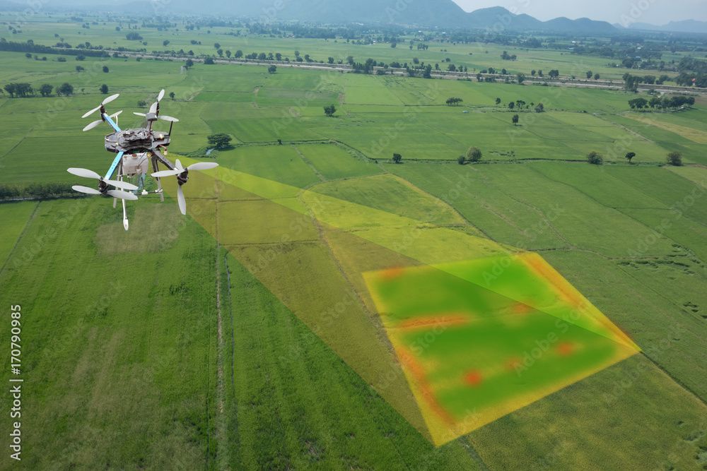
Our Drone Surveying and Aerial Mapping Capabilities
Aerial Topographic Mapping
Drone technology can assist our team in documenting terrain, elevations, improvements and existing site conditions. The collected aerial information can support topographic surveys used for planning, engineering, grading, drainage and development projects.
Existing-Condition Mapping
Accurate information about current site conditions is essential before design or construction begins. Aerial imagery provides a broad and detailed view of buildings, roads, vegetation, drainage features, utilities, improvements and surrounding property conditions.
High-Resolution Orthomosaic Imagery
Overlapping aerial images can be processed into a detailed orthomosaic—a geometrically corrected aerial image that provides a consistent, measurable view of the project area. Orthomosaic imagery can support site evaluation, planning, documentation and coordination among project stakeholders.
Construction Progress Documentation
Scheduled drone flights can document how a project changes over time. Aerial construction mapping gives owners, contractors, engineers and project managers a clear visual record of site development, grading, infrastructure installation and overall construction progress.
Earthwork and Site Analysis
Aerial mapping can support earthwork evaluation by documenting terrain, stockpiles, excavation areas and changing site conditions. Depending on the project scope, the collected data may be used to help develop surface models, calculate volumes and coordinate grading activities.
Large-Site and Difficult-Terrain Mapping
Drones can collect information across large or challenging areas more efficiently than ground methods alone. This can be especially helpful for agricultural properties, undeveloped land, infrastructure corridors, drainage facilities and locations with limited or potentially unsafe access.
Aerial Photography and Project Visualization
High-resolution aerial imagery gives clients, engineers, planners and public agencies a clearer understanding of a property and its surroundings. These visuals can support project presentations, planning discussions, agency coordination and construction documentation.
Potential Aerial MApping Deliverables
Deliverables are selected according to the project’s objectives, accuracy requirements and intended use. Depending on the scope, Laugenour and Meikle’s drone surveying and aerial mapping services may support the development of:
High-resolution aerial imagery
Georeferenced orthomosaic maps
Existing-condition maps
Topographic survey information
Contour and elevation mapping
Digital surface models
Three-dimensional site representations
Earthwork and stockpile calculations
Construction progress imagery
Site-planning base information
CAD and Civil 3D project data
Aerial documentation for engineering and public works projects
Our team will discuss the required information and final file formats before beginning the project.
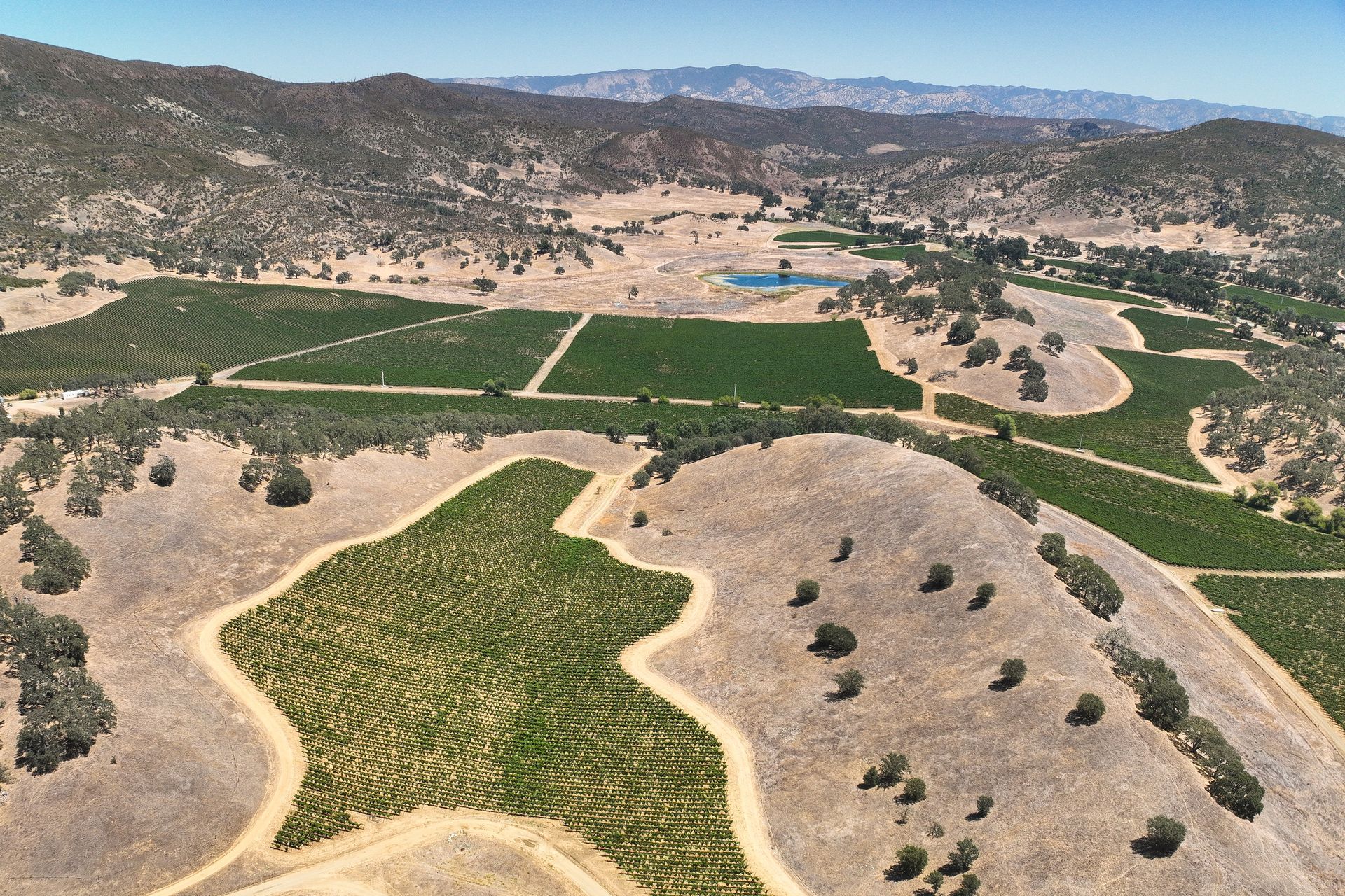
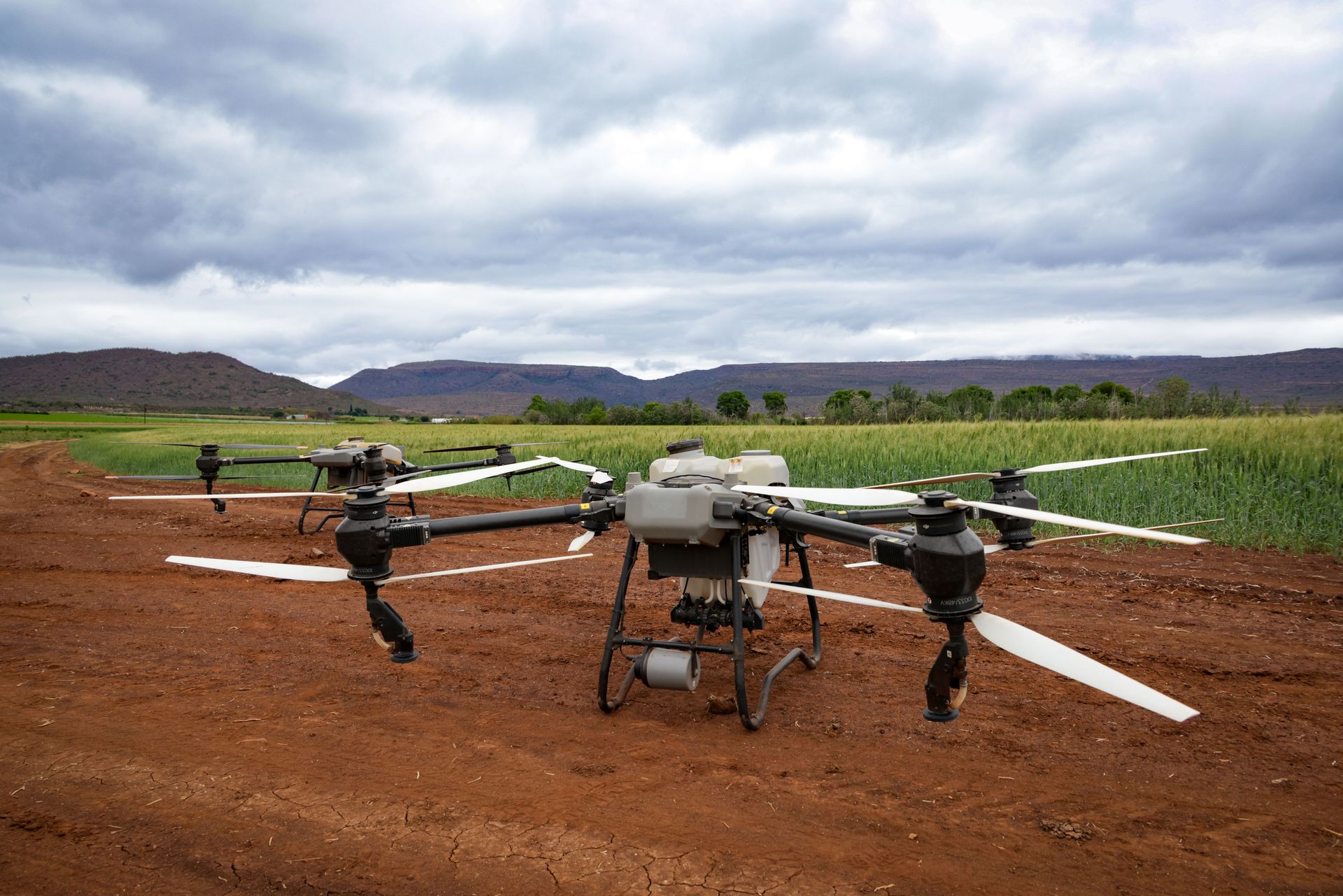
Advanced RTK Aerial Mapping Equipment
Laugenour and Meikle has access to multiple professional aerial mapping platforms, allowing our team to select equipment based on the size of the site, terrain, airspace, project requirements and information that must be collected.
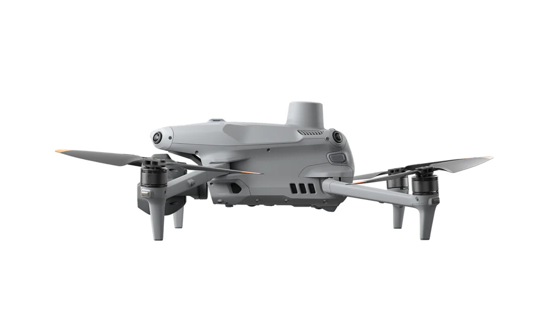
DJI Matrice 4E RTK Aerial Mapping Drone
The DJI Matrice 4E RTK provides advanced aerial mapping capabilities for large, detailed and complex project sites. Its RTK positioning and imaging capabilities help our team efficiently collect georeferenced aerial information for topographic mapping, site planning, construction documentation and existing-condition surveys.
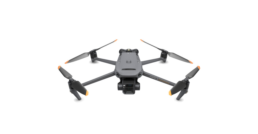
DJI Mavic 3E RTK Aerial Mapping Drone
The DJI Mavic 3E RTK offers a compact and flexible aerial mapping solution. Its portability makes it well suited for documenting a variety of properties and project areas while collecting high-resolution imagery that complements information gathered by Laugenour and Meikle’s ground-based survey crews.
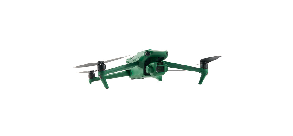
Anzu Robotics Raptor RTK Aerial Mapping Drone
The Anzu Robotics Raptor RTK gives Laugenour and Meikle another professional platform for aerial data collection, mapping and site documentation. Having multiple RTK drones available allows us to select an appropriate aerial platform for the site conditions, project scope and desired deliverables.
Benefits of Drone Surveying and Aerial Mapping
Boundary Surveying Services We Provide
Efficient Site Data Collection
Aerial mapping drones can document large project areas efficiently while collecting detailed information from a consistent overhead perspective.
Detailed Site Coverage
High-resolution aerial imagery helps create a more complete view of the property, including terrain, improvements, access routes and surrounding conditions.
Access to Challenging Locations
Drones can collect information in locations that may be difficult, time-consuming or potentially unsafe to reach on foot.
Improved Project Coordination
Aerial maps and imagery make it easier for owners, engineers, architects, contractors, planners and public agencies to understand existing conditions and communicate about a project.
Integration With Ground Surveying
Laugenour and Meikle can combine aerial data with GPS, robotic surveying and conventional field methods. This integrated approach helps ensure that the information collected is appropriate for the project and its intended use.
Clear Visual Documentation
Aerial imagery provides an understandable visual record that can support planning, design, construction meetings, progress reporting and stakeholder communication.
Application for Drone Surveying
Our aerial surveying and mapping capabilities can support a wide range of projects, including:
Residential and commercial development
Industrial properties
Agricultural land and facilities
Schools and institutional campuses
Public works and infrastructure
Roadway and utility projects
Parks and recreational facilities
Grading and drainage projects
Construction monitoring
Solar field planning and layout
Existing-condition documentation
Environmental and water-resource planning
Large or difficult-to-access properties
Why Choose Laugenour and Meikle?
Advanced equipment is only as effective as the professionals operating it.
Since 1953, Laugenour and Meikle has provided civil engineering, land surveying, mapping and planning services for projects throughout Northern and Central California. Our team combines modern aerial technology with professional judgment, local knowledge, proven field practices and careful quality-control procedures.
Clients choose Laugenour and Meikle for:
Decades of land surveying and civil engineering experience
Professional RTK drone mapping equipment
Integrated aerial and ground-based surveying capabilities
Civil 3D mapping and engineering workflows
Experience with public and private development projects
Detailed project information and useful deliverables
Knowledge of regional properties, terrain and development requirements
A practical approach tailored to each project
Drone Mapping Across Northern and Central California
Laugenour and Meikle provides drone surveying and aerial mapping services throughout Northern and Central California, including:
Woodland
Davis
Sacramento
West Sacramento
Yolo County
Sacramento County
Solano County
Colusa County
Napa and the surrounding Wine Country
San Francisco Bay Area
Additional communities throughout Northern California
Project availability may depend on site conditions, airspace restrictions, weather and the required surveying deliverables. Contact Laugenour and Meikle to discuss the location and requirements of your project.
FREQUENTLY ASKED QUESTIONS ABOUT Drone Surveying and Aerial Mapping
What is the difference between drone mapping and a land survey?
Drone mapping is a method of collecting aerial imagery and georeferenced site data. A professional land survey applies surveying standards, field measurements, research and professional judgment to establish or document specific property and site information.
Laugenour and Meikle may use drone mapping as one component of a larger professional surveying assignment, depending on the project requirements.
How accurate is RTK drone mapping?
RTK technology improves the positioning of aerial data, but final accuracy can depend on the equipment, flight plan, ground control, terrain, vegetation, weather, processing methods and required deliverables. Laugenour and Meikle evaluates these factors and determines whether aerial mapping, ground surveying or a combination of methods is appropriate.
What does RTK mean in drone surveying?
RTK stands for Real-Time Kinematic. It is a positioning method that uses correction information to improve the accuracy of location data collected during a drone flight. RTK technology helps aerial information align more accurately with project coordinates and ground-based survey data.
What types of projects benefit from aerial mapping?
Drone mapping can be valuable for land development, topographic surveys, construction monitoring, agricultural properties, infrastructure projects, earthwork analysis, public works and large or difficult-to-access project sites.
Can drone mapping be used for topographic surveys?
Yes. Aerial data can support topographic mapping by documenting terrain, elevations and visible site features. Depending on the project, Laugenour and Meikle may combine drone imagery with GPS, robotic or conventional ground measurements to develop the required topographic information.
What is an orthomosaic map?
An orthomosaic is a collection of overlapping aerial images that has been processed into one geometrically corrected image. Unlike a basic aerial photograph, an orthomosaic provides a consistent overhead view that can be referenced and measured within a mapping workflow.
Can drones document construction progress?
Yes. Drone flights can be performed at selected stages to create a visual record of grading, improvements, infrastructure and overall construction progress. The resulting imagery can help owners, engineers, contractors and project managers review changing site conditions.
Can you map properties with trees or heavy vegetation?
Vegetation can obstruct the ground and limit what standard aerial imagery can capture. Laugenour and Meikle will evaluate the site and determine whether drone mapping can provide the required information or whether additional ground-based surveying methods are needed.
What can affect a drone surveying flight?
Weather, wind, visibility, surrounding structures, vegetation, site access and controlled airspace can all affect aerial operations. Laugenour and Meikle reviews site conditions and project requirements when planning the work.
Does LMCE provide drone surveying near Sacramento?
Yes. Laugenour and Meikle provides aerial mapping and professional surveying services in Sacramento, Woodland, Davis, West Sacramento, Yolo County and other communities throughout Northern and Central California.
Start Your Drone Surveying Project
Accurate aerial information can give your team a clearer understanding of existing conditions and help support better planning, design and construction decisions.
Contact Laugenour and Meikle to discuss your project. Our team will evaluate the property, required accuracy, desired deliverables and intended use to determine whether drone surveying, ground-based surveying or a combination of methods is best suited to your needs.