

Laugenour and Meikle provides professional hydrographic surveying and bathymetric mapping services for ponds, canals, reservoirs, rivers and other bodies of water throughout Northern and Central California.
Using focused-beam sonar, GPS positioning and remote-controlled survey technology, our experienced team collects detailed water-depth measurements and underwater surface information. This data can support civil engineering, drainage, water-resource, agricultural, environmental, dredging and public infrastructure projects.
Whether your project requires underwater cross sections, bottom-surface mapping or documentation of existing water conditions, LMCE can develop a surveying approach based on the site, project objectives and required deliverables.
Hydrographic Surveying & Bathymetric Mapping in Northern California
Accurate Water-Depth Data for Engineering, Planning and Infrastructure Projects
If you have a project you'd like to speak with us about, please submit a request and we will be in touch.
Since 1953
Civil Engineering
Land Surveying
Planning
Northern & Central California
Professional Hydrographic Surveying and Water-Depth Mapping
Experts in Civil Engineering since 1953
Hydrographic surveying is the process of measuring and mapping underwater conditions. While a conventional topographic survey documents features and elevations above water, a hydrographic survey collects depth measurements and bottom-surface information below the waterline.
These measurements can be used to better understand the shape, depth and changing conditions of a pond, canal, reservoir, river or drainage facility. Depending on the project, hydrographic data may be combined with shoreline surveys, GPS positioning, conventional field measurements and existing engineering information.
LMCE uses advanced sonar and remote-controlled survey equipment to gather reliable information while reducing the need to place personnel directly on the water.
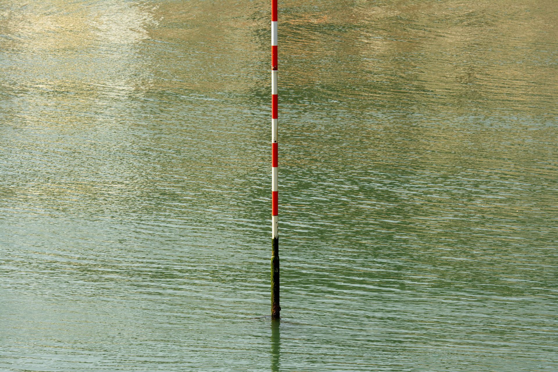
Our Hydrographic Surveying Capabilities
Bathymetric Mapping
Bathymetric mapping documents the underwater terrain or bottom surface of a body of water. Similar to a land-based topographic map, bathymetric information can show variations in depth, underwater slopes and bottom elevations.
This information can support engineering design, water-resource planning, capacity analysis, maintenance planning and environmental evaluation.
Sonar Water-Depth Mapping
Focused-beam sonar sends sound signals toward the bottom of the water body and measures their return. These measurements help our surveyors collect detailed water-depth information along planned survey routes.
Sonar water-depth mapping can be used in ponds, canals, reservoirs, rivers, drainage facilities and other accessible bodies of water.
Hydrographic Cross-Section Surveys
Underwater cross sections show the shape and depth of a waterway or facility at selected locations. They can help engineers evaluate channel geometry, drainage conditions, sediment buildup, water conveyance and changes in the bottom surface.
Hydrographic cross sections may be useful for canals, rivers, drainage channels, reservoirs and water-control infrastructure.
Pond and Reservoir Surveys
LMCE can collect water-depth and bottom-surface information for ponds and reservoirs. The resulting data may support capacity evaluation, maintenance planning, sediment analysis, infrastructure improvements and water-resource management.
Canal and Waterway Surveys
Hydrographic surveying can help document the underwater condition of irrigation canals, drainage canals, rivers and other waterways. Survey information may be used to evaluate channel depths, cross sections, obstructions, sediment conditions and existing infrastructure.
Sediment and Bottom-Condition Documentation
Over time, sediment can accumulate and change the depth or capacity of a pond, reservoir, canal or drainage facility. Hydrographic data can help document the current bottom surface and identify areas where sediment may have accumulated.
When previous survey information is available, current measurements may also help evaluate how underwater conditions have changed over time.
Dredging and Maintenance Support
Accurate existing-condition information is important when evaluating dredging or waterway-maintenance projects. Hydrographic surveys can help identify bottom elevations, areas of sediment accumulation and underwater conditions that may affect the scope of the proposed work.
LMCE can coordinate collected hydrographic information with civil engineering and mapping workflows to support project planning and design.
Advanced Hydrographic Surveying Equipment
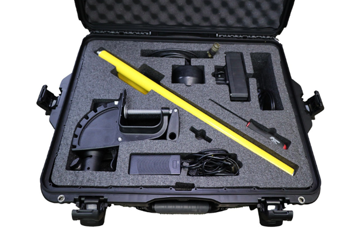
HydroLite TM2 Focused-Beam Sonar
The HydroLite TM2 focused-beam sonar system allows LMCE to collect water-depth measurements in ponds, canals, reservoirs, rivers and other bodies of water.
When combined with accurate positioning information, these measurements help our team develop underwater cross sections and bottom-surface data for drainage, water-resource, sediment, infrastructure and environmental projects.
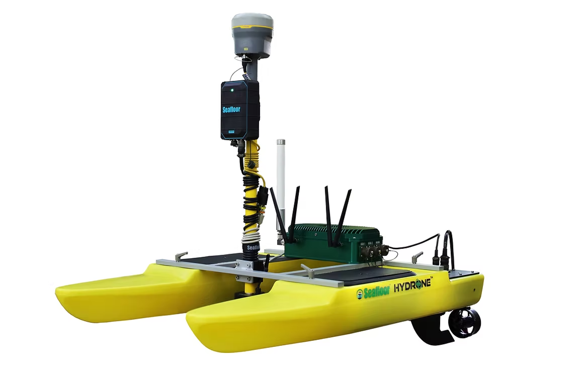
Seafloor HyDrone Remote-Controlled Survey Boat
The Seafloor HyDrone is a remote-controlled survey vessel that allows our team to collect hydrographic information without placing survey personnel directly on the water.
When equipped with sonar and positioning technology, the HyDrone can follow planned survey routes and collect water-depth measurements in areas that may be difficult, inefficient or potentially unsafe to access using conventional boats or manual methods.
The HyDrone can be particularly useful for smaller bodies of water, shallow areas, confined waterways and locations with limited access.
Learn more about LMCE’s surveying equipment and mapping technology.
Benefits of Remote Hydrographic Surveying
Boundary Surveying Services We Provide
Detailed Underwater Information
Sonar technology allows our team to collect depth measurements and bottom-surface information that cannot be documented through conventional land surveying alone.
Safer Data Collection
Remote-controlled survey equipment can reduce the need to place personnel directly on the water, particularly in shallow, confined or difficult-to-access areas.
Access to Challenging Locations
The compact Seafloor HyDrone can collect information in locations where launching or operating a conventional survey boat may be difficult.
Efficient Survey Coverage
Planned survey routes allow sonar and positioning equipment to collect a series of coordinated measurements across the project area.
Integration With Land-Based Surveys
Hydrographic measurements can be combined with shoreline mapping, GPS surveying, robotic surveying and conventional field data to create a more complete understanding of existing conditions.
Useful Engineering Data
LMCE can coordinate hydrographic information with Civil 3D, mapping and civil engineering workflows, helping clients use the collected data for planning, design, maintenance and infrastructure decisions.
Potential Hydrographic Deliverables
Final deliverables are selected according to the project objectives, site conditions and intended use. Depending on the scope, Laugenour and Meikle’s hydrographic surveying and bathymetric mapping services may support the development of:
Water-depth measurements
Hydrographic cross sections
Bathymetric maps
Underwater contour information
Bottom-surface models
Pond and reservoir mapping
Canal and channel profiles
Shoreline and water-edge documentation
Sediment-condition information
Existing-condition maps
CAD and Civil 3D project data
Survey information for engineering analysis
Mapping for maintenance or dredging planning
Our team will discuss the required information, accuracy standards and file formats before beginning the survey.
Applications for Hydrographic Surveying
Hydrographic and bathymetric surveying can support a variety of public and private projects, including:
Agricultural ponds and reservoirs
Irrigation canals
Drainage channels and detention facilities
Rivers and waterways
Municipal water facilities
Flood-control infrastructure
Water-storage facilities
Sediment and capacity evaluations
Dredging and maintenance planning
Bridge and crossing projects
Environmental planning
Water-resource studies
Existing-condition documentation
Public works and infrastructure improvements
Our Hydrographic Surveying Process
Project Evaluation
We begin by discussing the body of water, project objectives, available site information, required deliverables and how the survey data will be used.
Survey Planning
Our team evaluates site access, water conditions, anticipated depths, shoreline conditions, potential obstructions and the appropriate spacing of survey routes or cross sections.
Field Data Collection
Laugneour and Meikle uses sonar, GPS positioning and the Seafloor HyDrone to collect water-depth information along planned survey paths. Ground-based surveying may also be performed when shoreline elevations or surrounding site conditions are required.
Data Review and Processing
Collected measurements are reviewed and processed to develop the maps, cross sections, contours or surface information required for the project.
Final Deliverables
The completed survey information is prepared in the agreed-upon format and coordinated with the client’s engineering, planning or maintenance objectives.
Serving Northern and Central California
Based in Woodland, Laugenour and Meikle provides civil engineering services throughout the Sacramento Valley and surrounding regions. Our service area includes Woodland, Davis, Sacramento, West Sacramento, Yolo County, the San Francisco Bay Area, Napa Wine Country, the Central Valley, and communities throughout Northern and Central California.
FREQUENTLY ASKED QUESTIONS ABOUT CIVIL ENGINEERING
What is a hydrographic survey?
A hydrographic survey measures and maps underwater conditions. It may include water depths, bottom elevations, cross sections, underwater contours and shoreline information. The resulting data can support engineering, drainage, water-resource, environmental, infrastructure and maintenance projects.
What is bathymetric mapping?
Bathymetric mapping documents the shape and elevation of an underwater surface. It is similar to topographic mapping on land, except the measurements represent depths and bottom conditions beneath the water.
What types of bodies of water can LMCE survey?
Depending on site access and conditions, LMCE can provide hydrographic surveying for ponds, canals, reservoirs, rivers, drainage facilities and other bodies of water. Our team evaluates each site to determine whether the HydroLite sonar, Seafloor HyDrone or another surveying method is appropriate.
How does sonar water-depth mapping work?
Sonar equipment sends a sound signal toward the bottom of the water and measures the time required for the signal to return. When the depth measurement is combined with accurate positioning data, the surveyor can map where each underwater measurement was collected.
What is the Seafloor HyDrone?
The Seafloor HyDrone is a remote-controlled survey boat that carries sonar and positioning equipment. It allows LMCE to collect water-depth information without placing survey personnel directly on the water.
What is a hydrographic cross section?
A hydrographic cross section shows the shape and depth of a waterway or water-storage facility at a selected location. Cross sections can help evaluate channel geometry, bottom elevations, sediment accumulation and water-conveyance conditions.
Can a hydrographic survey help identify sediment buildup?
Yes. Hydrographic surveying can document the current bottom surface and identify variations in depth that may indicate sediment accumulation. If reliable previous survey data is available, it may also be possible to compare past and current conditions.
Can hydrographic data support dredging projects?
Hydrographic survey information can help document existing bottom elevations, water depths and areas of sediment accumulation. This information may be used by engineers, owners and contractors when evaluating or planning dredging and maintenance work.
Can underwater measurements be combined with a topographic survey?
Yes. LMCE can combine hydrographic measurements with shoreline elevations, surrounding topography and other ground-based survey information to provide a more complete representation of the site.
Does LMCE provide hydrographic surveying near Sacramento?
Yes. LMCE serves Sacramento, Woodland, Davis, West Sacramento, Yolo County and other communities throughout Northern and Central California.
Start Your Hydrographic Surveying Project
Reliable underwater information is essential when planning improvements, evaluating sediment, documenting water depths or managing water-related infrastructure.
Contact Laugenour and Meikle to discuss your pond, canal, reservoir, river or water-resource project. Our team will evaluate the site, required measurements and intended use of the data to determine an appropriate hydrographic surveying approach.